
Last modified: 2022-03-05 by ian macdonald
Keywords: parana | iporã |
Links: FOTW homepage |
search |
disclaimer and copyright |
write us |
mirrors
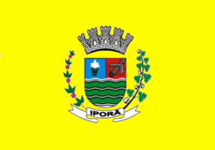 image by Ivan Sache, 3 February 2022
The municipality of Iporã (13,926 inhabitants in 2019; 64,789 ha) is located
600 km west of Curitiba. The municipality is composed of the districts of Iporã
(seat), Cafezal (established by Municipal Law No. 32 promulgated on 28 September
1967), Guaiporã (est. by State Law No. 7,622 promulgated on 15 June 1982),
Jangada (est. by State Law No. 7,622 promulgated on 15 June 1982), Nilza (est.
by State Law No. 7,622 promulgated on 15 June 1982), and Oroite (est. by State
Law No. 5,777 promulgated on 24 May 1968, formerly known as Santa Helena).
Iporã was developed by Sociedade imobiliária Noroeste do Paraná Limitada (Sinopterras
Ltda), a colonizing company established by Enio Pipino and João Pedro Moreira de
Carvalho. Originally known as Atlântida, the place was renamed to Iporã, a
Tupi-Guarani name meaning "Good Water", referring to the abundance in
freshwater.
The district of Iporã was established as part of the municipality
of Cruzeiro do Oeste by Municipal Law No. 12 promulgated on 24 April 1955, to be
elevated a municipality by State Law No. 4,245 promulgated on 25 July 1960.
https://ipora.pr.gov.br/
Municipal website
The flag of Iporã is yellow with the municipal coat of
arms in the center.
Photo
https://www.facebook.com/prefeituraipora/photos/145901814157074
Videos
https://www.facebook.com/Câmara-Municipal-de-Iporã-109520410726098/videos/
Ivan Sache, 3 February 2022